#태그
#태그
Time Travel in Eunpyeong
📃 연구제목 「은평한옥마을 지역의 역사 탐구 및 외국인 관광객을 대상으로 한 게시글 작성」
✒ 융합탐구팀 김정민 박건후 박세환 윤혜원 정찬훈 함인태
📅 Oct 2022
🇰🇷 한국어 버전 보러 가기.
Introduction
CC BY-SA 4.0 | Creator: Mobius6 | 링크
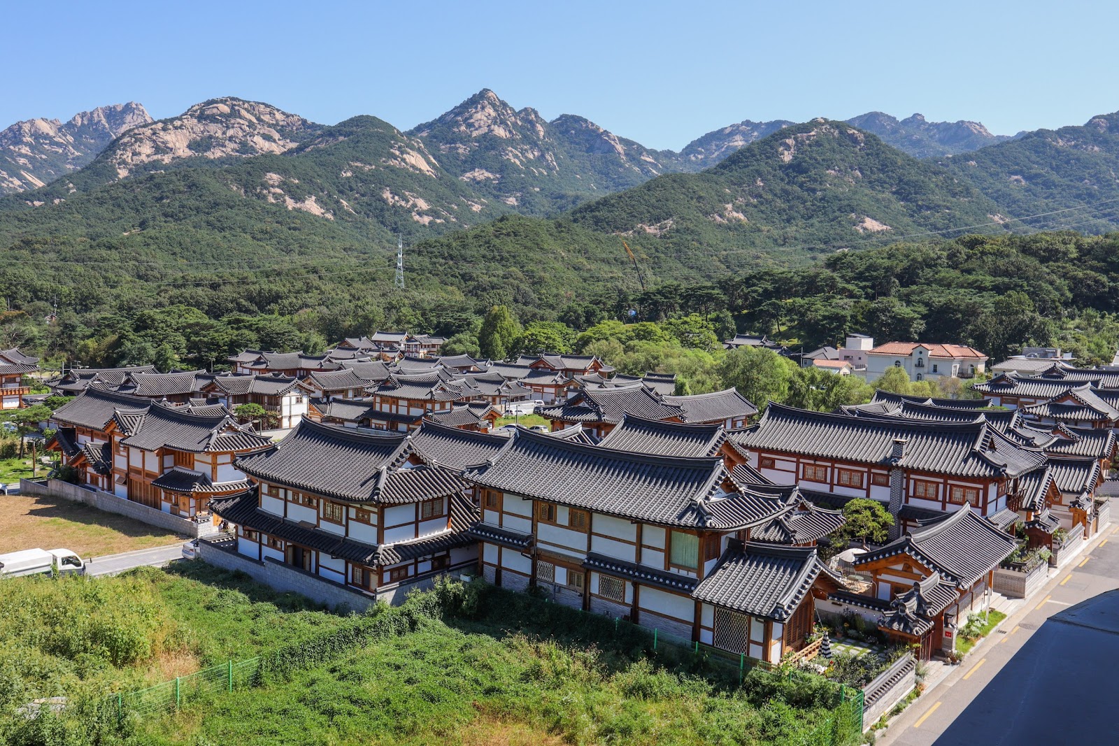
The Eunpyeong Hanok Village was built in 2010 at Jingwan-dong, Eunpyeong-gu in Seoul. In addition to housing residents, the village was later designated as an area for authentic Korean culture experience with programs including the Hanok stay and more. Although the village itself was built recently, the rich long history of the Jingwan-dong Eunpyeong-gu site makes the village worth visiting.
CHAPTER I
History — Eunpyeong-gu
Three Kingdoms Period
Eunpyeong was located in the lower course of the Han River, an area with fertile land and thriving trades. Being so, Goguryeo, Baekje, and Silla often fought to gain control of the area. Indeed, Eunpyeong was a very important military base at the time, constantly occupied by different kingdoms. Under Baekje, it was part of the Wiryeseong area; under Silla, the Shinju area; and during the Unified Silla period, the Hansanju area. Later into the Unified Silla period under King Gyeongdeok, Eunpyeong was called Hanju.
Goryeo Dynasty
After Goryeo’s reunification of the Later Three Kingdoms, during the Goryeo Dynasty, Eunpyeong was called Yangju. Under King Munjong’s reign, the area was made into a district known as Namgyeong, part of the three Sogyeongs. Later, due to policies promoting agriculture, agricultural productivity increased especially in this area. Since it was located around the Han River, this area also played a major role as a transportational route of agricultural products to the capital.
Joseon Dynasty
During the Joseon Dynasty, the administrative system was reorganized into 5-bu/52-bang, dividing Eunpyeong into yeoneunbang and sangpyeongbang. The name “Eunpyeong” is a combination of the the “Eun” from yeoneunbang and the “Pyeong” from sangpyeongbang. At the time, graves weren’t allowed within about 4 km from the city's walls. Because Eunpyeong was about 4 km away from the boundaries, it was an essential area as a cemetery. The people also thought that the land was sacred in a way because Jingwannaecheon Stream flows in the front and the area is surrounded by mountains, another reason the area was very popular as a cemetery. Many of the relics are currently displayed in the Eunpyeong History Hanok Museum to commemorate the dead.
During & After Japanese Colonial Rule
When the nation lost its sovereignty in 1910, the administrative system was once again reorganized into 5-bu/35-bang/8-myeon, Eunpyeong-myeon was incorporated into Goyang-gun Gyeonggi-do in 1913, then back to Seoul in August of 1949.
1960s — The Industrialisation Period
In July of 1973, Jingwannae-li, Jingwanwe-li, Gupabal, Shindo-myeon, Goyang-gun were incorporated into Seodaemun-gu, forming the Eunpyeong area as it is now. In 1979, Eunpyeong separated from Seodaemun-gu and became Eunpyeong-gu. After a number of administrative integrations and abolitions, eleven Legal Dong and sixteen Dong of Administration were fixed in June of 2008 and maintained to this day. From 1966 to 1978, the area underwent a housing land development project which transformed the farmland into a residential area. From 1969, the Hanyang housing complex was built and several multi-complex houses and multi-family houses came along.
Finally — Development of the Eunpyeong New Town
In 2002, Eunpyeong New Town was selected as a demonstrative new town district along with the Gileum-dong and Wangsimni-dong. The project strived for a “resort-type garden city”, a “future-oriented community”, and a “significantly improved quality of housing”; overall, an eco-friendly city.
From 2006 to 2009, excavations and investigations of the site were carried out. In the south slope of Imal Mountain, a total of 3487 sites were found including stone chamber tomb from Unified Silla, 3466 tombs from the Joseon Dynasty, 3 pit dwellings, building sites, stone structures, and a kiln. 4979 artifacts, including ceramics, were also excavated. In the two branch ridges extended northwest from the Bukhansan Mountain, 493 tombs presumably from the Joseon Dynasty, were identified. In the excavation of district 3, buildings from the Goryeo Dynasty, fence facilities, wells, tile kilns and kiln sites from the Unified Silla period were also found along with tombs.
A total of over 8000 artifacts, especially the Buncheong porcelain bowls, white porcelain, Joseon coins, glass beads, earrings, drew attention from the academia of South Korea. In addition, roof tiles and building sites presumed to be part of Hwaeom temple Cheongdamsa, recorded in written records (a Buddhist Temple) from the Unified Silla period, were identified. This indicates that the area of Eunpyeong was the center of Buddhism in Seoul at the time. Many of the relics excavated are exhibited at the Eunpyeong History Hanok Museum located in Eunpyeong Hanok Village.
The ratio of green land in Eunpyeong New Town is 42%, higher than the 36% of the Pangyo-dong area. The highest buildings have 15 floors, keeping the floor area ratio low at 140%, a factor in Eunpyeong being a very comfortable place to live. In 2011, the plan to build a Hanok Village was confirmed and sales began in September of 2021. 156 lots were created in the 65,500 square meters of land in 3-2 District. The Eunpyeong History Hanok Museum was established in 2014 to preserve, exhibit, and provide an experience of cultural contents related to the Hanok.
Reference
- <고려사> 권5, 세가5, 현종 18년 6월 14일
- <고려사> 권4, 세가4, 현종 총서.
- 김광식, 한상길, <진관사>, 대한불교조계종 불교사회연구소, 2018, 12~21쪽
- <동문선> 권78, 기, 진관사수륙사조성기
- <태종실록> 권35, 태종 18년 3월 3일(계축)
- 서울역사박물관, <은평발굴 그 특별한 이야기>, 2009
- 서울역사편찬원, <서울의 발굴현장>, 2017, 401~408쪽
CHAPTER II
History — Jingwan-dong
Screenshot | 링크
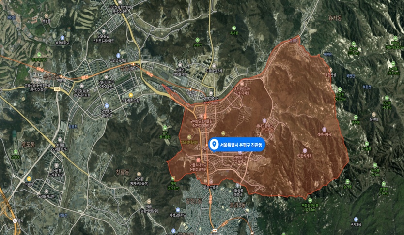
Jingwan-dong is located inside the northern end of Eunpyeong-gu. A large area of Jingwan-dong has been designated as a development restriction zone and military protection zone. It borders Goyang-si to the west and north, Jongno-gu to the east, and Galhyeon and Bulgwang-dong to the south.
공공누리 (출처표시) | Creator: 한국학중앙연구원, 김광섭 | 링크
During the Joseon Dynasty, Jingwan-dong was part of Sinhyeol-myeon, Yangju-gun. From 1906, it was part of Goyang-gun until 1973 when it was incorporated into Seoul and renamed Jingwan-dong, Seodaemun-gu. In 1975 it was divided into Jingwannae-dong and Jingwanwe-dong to later be reunified in August of 2007. Jingwan-dong has been under the jurisdiction of Eunpyeong-gu since 1979.
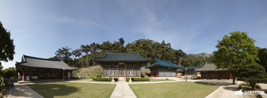
The story of “Jingwan-dong” dates back to the Goryeo Dynasty. Before Hyeonjong became the 8th king of Goryeo, his life was threatened by Empress Cheonchu, who held power instead of the young King Mokjong. A monk named Jingwan protected Hyeonjong from assassins sent by the Empress and took care of him. Later when Hyeonjong ascended the throne, he repaid the monk by building Jingwansa Temple in honor of Jingwan. The name “Jingwan-dong” is derived from this story.
Reference
- https://www.ep.go.kr/www/contents.do?key=841
- https://www.doopedia.co.kr/doopedia/master/master.do?_method=view&MAS_IDX=101013000743461
CHAPTER III
Geography
Feng shui, the harmony of individuals with their surrounding environment, is traditionally the greatest factor when it comes to a village’s establishment. Myeongdang, or the most ideal location where the vitality of nature gathers, generally refers to the topography of Basesanimsu, with a mountain in the back of the village and water flowing in the front.
In addition, villages with a difference in elevations were preferred. This is because Korea was a clan society at the time. The first house into the village, is located on the highest land where one can overlook all the houses in the village. The other houses function around the main home, creating a sense of unity and close bondage within the village.
Although the Eunpyeong Hanok Village could not perfectly fulfill the traditional requirements, it is still quite similar to the topographical conditions of the ideal village. The area itself was acknowledged as a Myeongdang since the Goryeo Dynasty. During King Hyeonjong’s reign, King Hyeonjong decided that a temple built in the most ideal location would get rid of the bad luck at the time; constant Khitan Invasions. This led to the construction of the Jingwansa Temple, which fulfilled the criteria for the most ideal geographical location. Jingwannaesheon Stream flows in the front while the Bukhansan Mountain is located in the back. While the houses were not built sequentially but rather all at once, there is still a slope formed in the village showing characteristics of a clan society.
Reference
- http://contents.history.go.kr/front/km/view.do?levelId=km_039_0040_0010_0010_0010
- https://ncms.nculture.org/house/story/5976
CHAPTER IV
Étiquettes
CC BY-NC-ND 2.0 KR | Creator: 은평한옥역사박물관 | 링크
Please be aware that the commercial area is limited to the area near Yeon Seo-ro and that the residential area is also nearby. The residents of the Hanok Village often have complaints about the noise pollution in the area due to over-tourism. We hope that the people visiting would be able to fully enjoy the peaceful atmosphere without disrupting it.
We ask you to do the simple things like not littering, refrain from shouting, and not trespassing private residential areas.
Return to Main Page